Plan
Bring people together
Show the meeting point, mark parking nearby and label the entrance. Download your map and send it with the invitation.
Map the details ↗ MarkAndMapMAPS OVERVIEW
Open map maker
MarkAndMapMAPS OVERVIEW
Open map maker
Everyday plans. Bigger discoveries.
Plan a weekend away, show where to meet or put your next idea on the map. Explore free tools for local places, world views, country facts and a little friendly competition.
Free map tools · In your browser · No ads
Plan something togetherMeeting points, days out and places to remember.
Follow your curiosityCountry facts, historic maps and geography games.
Give your ideas a placeDownload a map for a slide, a post or a printout.
START WITH WHAT YOU WANT TO DO
From a pin around the corner to a new view of the whole world, start with an idea and choose the tool that fits.
Show the meeting point, mark parking nearby and label the entrance. Download your map and send it with the invitation.
Map the details ↗Find the stories behind nearby landmarks with Wiki Locations. Use the map maker to collect places you want to visit or remember.
Discover nearby places ↗Show project locations, label countries in a report or create a map for social media. Choose a local street view or an equal-area world map.
Create a world view ↗Compare country facts, explore an older map or challenge your geography knowledge. Let one discovery lead to the next.
Explore country facts ↗THE RIGHT MAP FOR THE MOMENT
Choose a map for what you want to do. Try a live map here, view a larger screenshot, or open the full tool to start exploring.
Mark meeting points, parking spots or favourite holiday places on street and satellite maps. Search an address, add pins and custom headings, then download an image for a presentation or a message.
Meetups · Travel memories · PresentationsOpen this mapPut your geography knowledge to the test by finding countries on an Equal Earth map. Pick a region and difficulty in Options, practise on your own or take turns with friends.
Quick breaks · Family challenges · Geography practiceOpen this mapShow a global idea with correctly proportioned country areas. Add country labels or place markers, choose a colour or outline style and download a clean PNG for a report, presentation or creative project.
World views · Reports · Creative projectsOpen this mapSee how Mercator changes our impression of country sizes. Select a country to compare its Equal Earth outline with its Mercator shadow, then download the comparison to explain what you found.
Country sizes · Visual explanations · CuriosityOpen this mapExplore population, area, density and GDP in a country facts popup. Use the figures as a starting point for research or to put a place in context, and download the map with the open facts card.
Country facts · Research · ComparisonsOpen this mapBrowse maps of Europe across different periods. Explore changing names and borders, add labelled markers and look at each map’s source to understand when and how it was made.
History · Place stories · ResearchOpen this mapEXPLORE WITH WIKI LOCATIONS
Explore a city, neighbourhood or landmark through Wikipedia places on the map. Select a green dot for its story; selected places also offer visitor details such as opening hours and accessibility when available.
Try it before a day outSelect “Try this map”, search for a place you want to explore and choose a green dot. Discover nearby sights and follow the source for more information.
Explore Wiki Locations ↗Explore the geography of men’s international football. Search by country, team code or rank to compare ranking points, historical best rankings and World Cup records. The map shows a dated ranking snapshot.
Team comparisons · Football trivia · Map downloadsExplore the ranking map ↗Discover the countries behind the 2026 tournament. Select a highlighted nation to explore team facts, World Cup history and its group table, then download the view for a football discussion or quiz.
Tournament countries · Team facts · Quiz nightsExplore the World Cup map ↗FROM MAP TO MESSAGE
A map can explain a meeting point, bring a presentation to life or keep the story of a trip. Download an image to add to a message, a document or a printout.
Create a printable world map ↗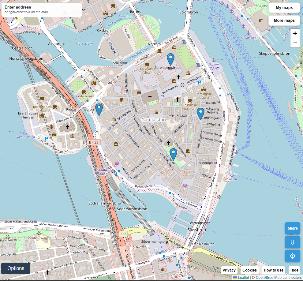
Use the main map maker for local places, or the Equal Earth World Map for countries. Add useful labels and choose a clear view.
Use the map’s download arrow (⇩) to save an image. Add it to a document or presentation. To return to an editable main map later, use a free account and “Save as new”.
Open the downloaded image and choose Print. Try landscape, fit to page and check the preview. An outline or monochrome world map works well for handwritten notes and annotations.
A FEW THINGS THAT HELP
You can explore the maps and play the Country Game without an account. A free account lets you save editable maps in the main map maker and return to them on another device. Image downloads do not require signing in.
Use the main map maker for streets, addresses and local plans. Choose the Equal Earth World Map for country labels and global views, or Wiki Locations to discover places nearby. The previews above let you try each tool.
Use the map’s download button to save an image, then add it to your slides or document. Keep the map attribution visible and check the source and licence information for historical maps.
Open a map and select “How to use”, or “How to play” in the Country Game. Historical Maps has a “Map info” panel with information about each map and its source. For learning activities, visit For Schools.
LET CURIOSITY LEAD